

Você está agora seguindo
Erro seguindo usuário.
Esse usuários não permite que o sigam.
Você já está seguindo esse usuário.
Seu plano permite apenas 0 seguidas. Aprimore-o aqui.
Deixou de seguir com sucesso
Ocorreu um erro ao deixar de seguir o usuário.
Você recomendou com sucesso
Ocorreu um erro ao recomendar o usuário.
Algo deu errado. Por favor, atualize a página e tente novamente.
E-mail verificado com sucesso

lahore,
pakistan
Atualmente, está 11:24 PM aqui
Ingressou em julho 13, 2017
0 Recomendações
Muneeb A.
@MUNEEBAAMIR
0,0
0,0
0%
0%
lahore,
pakistan
Não se aplica
Trabalhos Concluídos
Não se aplica
Dentro do Orçamento
Não se aplica
No Prazo
Não se aplica
Taxa de Recontratação
Geospatial Expert
Contate Muneeb A. sobre seu trabalho
Faça login para discutir quaisquer detalhes via chat.
Portfólio
Portfólio


Preparation of Digital Elevation Model
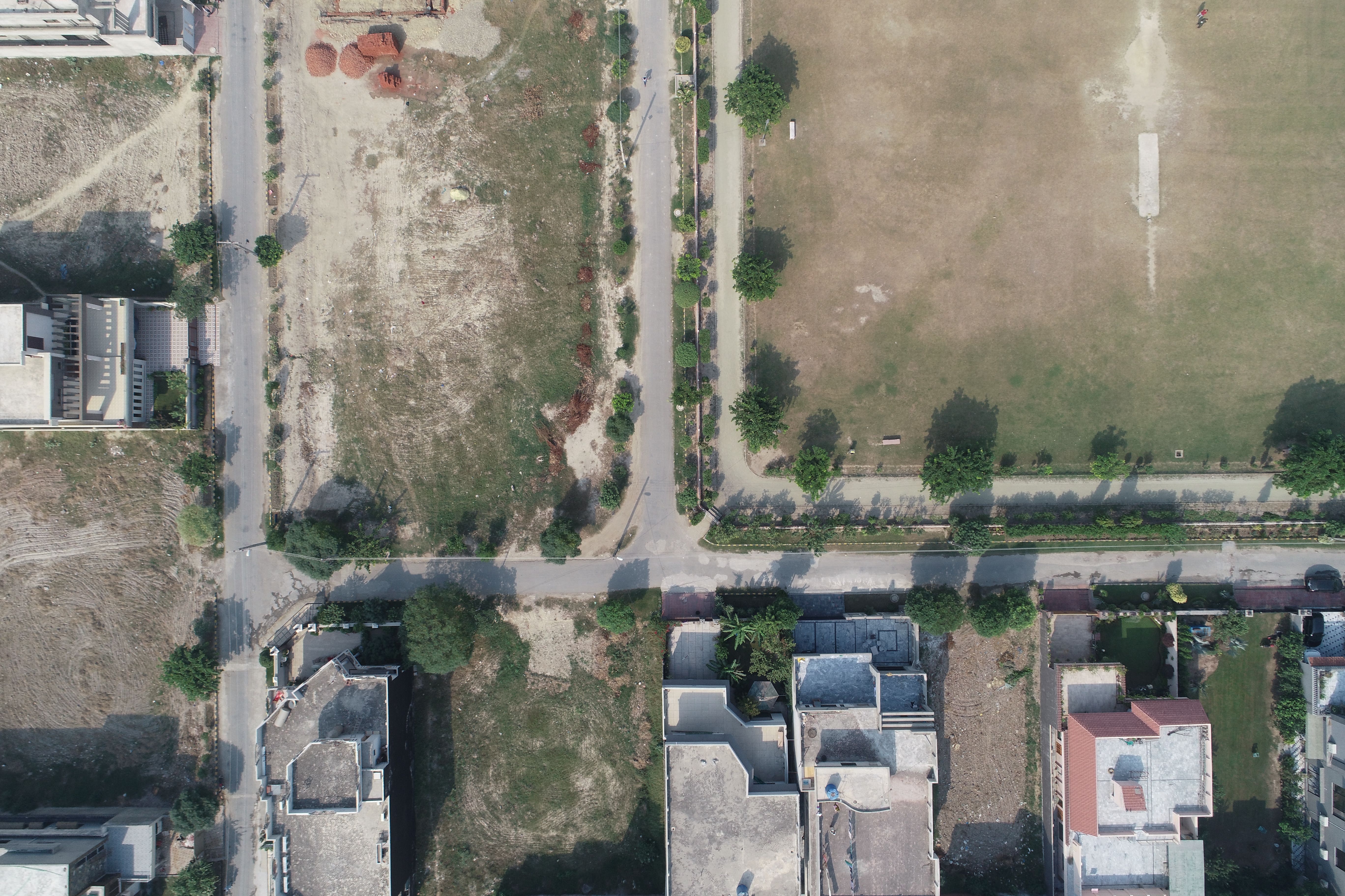

Drone Mapping

Drone Mapping

Drone Mapping
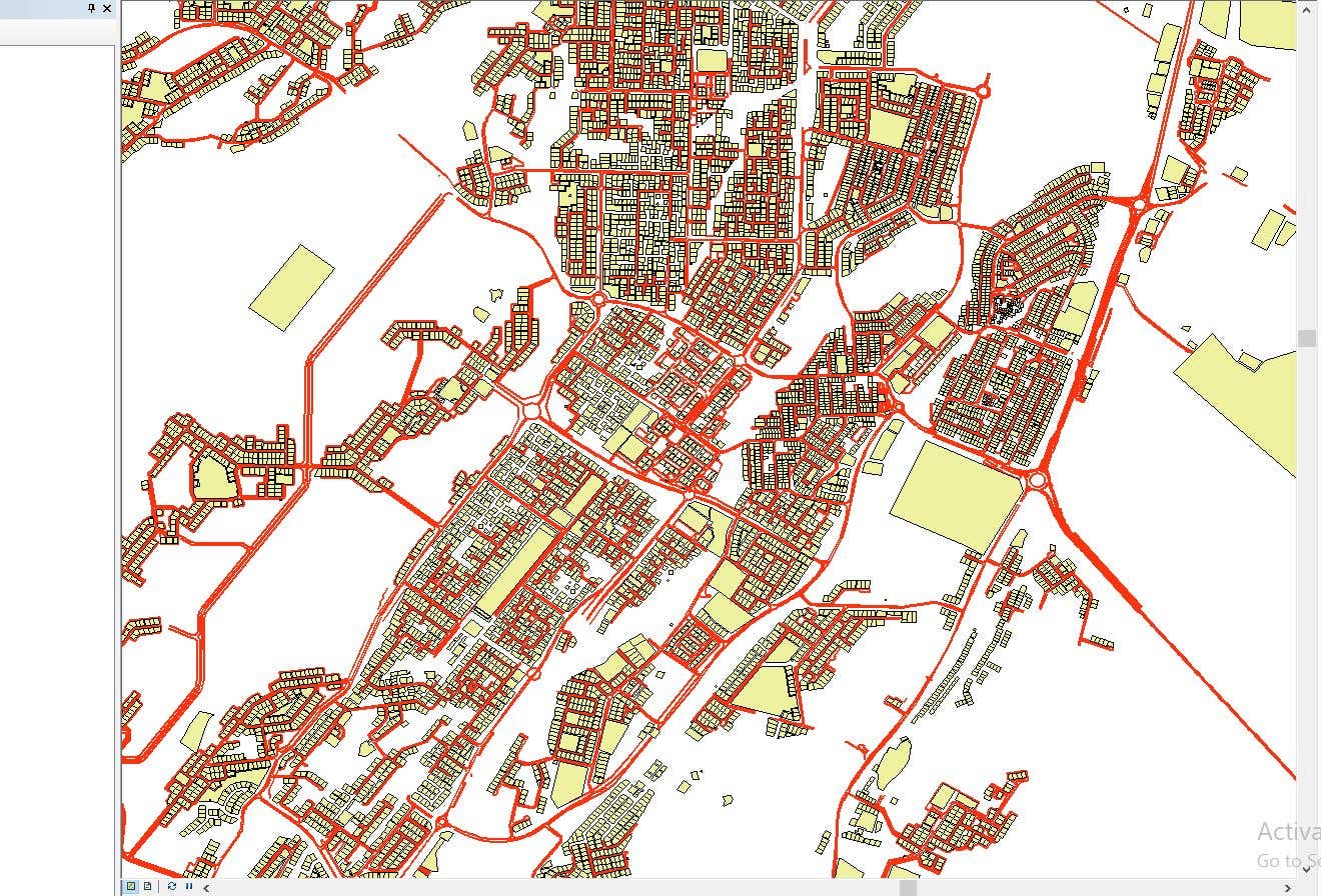

CAD to SHP Files

CAD to SHP Files
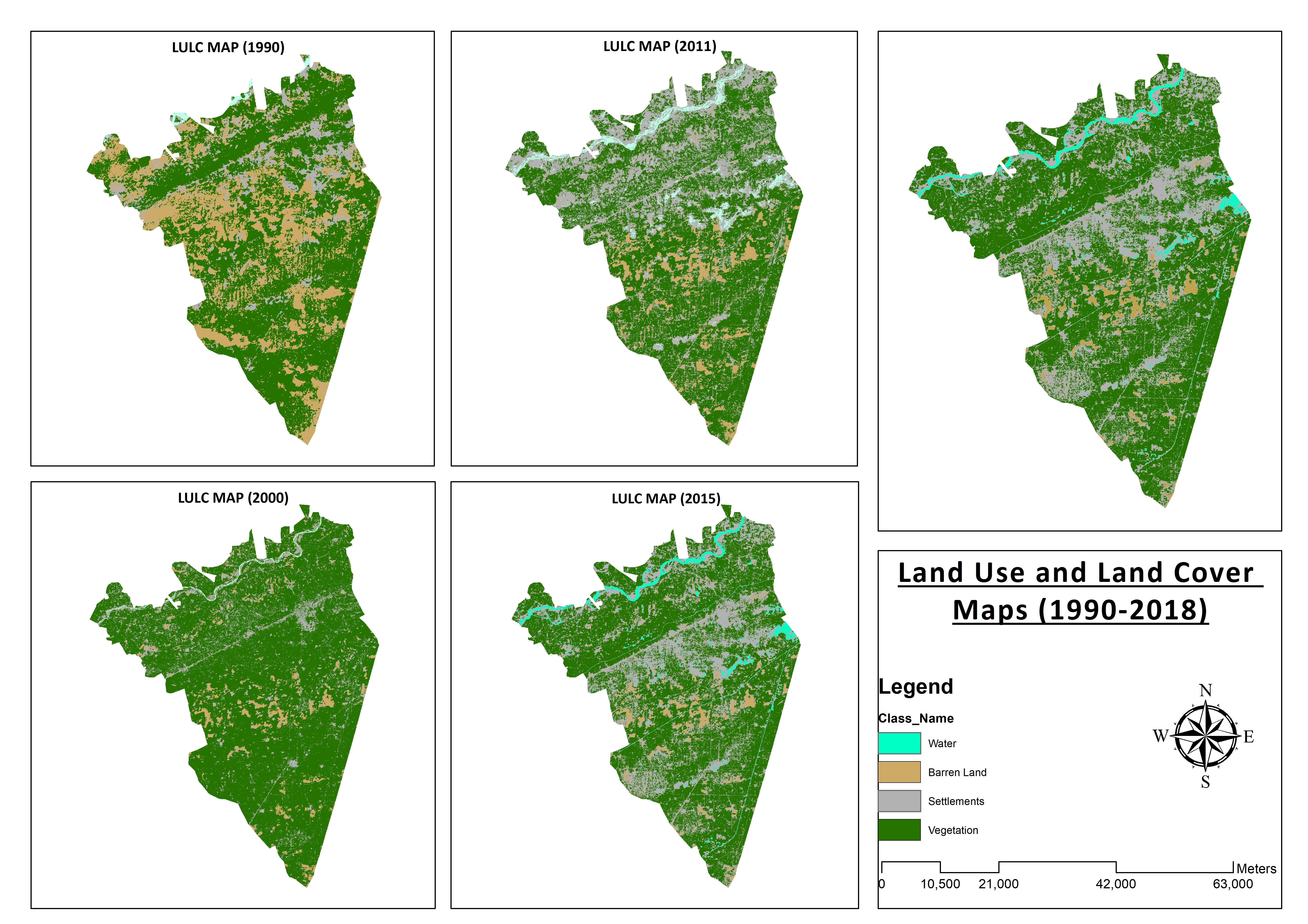

Land Use and Land Cover Maps
Preparation of Digital Elevation Model
Drone Mapping
Drone Mapping
Drone Mapping
CAD to SHP Files
CAD to SHP Files
Land Use and Land Cover Maps
Avaliações
Mudanças salvas
Nenhuma avaliação aqui!
Experiência
Remote Sensing and GIS Analyst
set. 2018 - out. 2019 (1 ano, 1 mês)
Developed, integrated and Implemented GIS and Geodesy based Topographic Survey Plans under different Hydro-Power Projects in Northern Pakistan, Extension of Canal Projects to increase its capacity in Sindh-Balochistan, Analysis of Suitable Site Selection for different development sites by using Drone for Aerial Mapping and their detailed pre-feasibility studies with different softwares, to analyse and interpret spatial data to produce interacting Maps and Reports while ensuring quality control.
Research Associate GIS
out. 2015 - out. 2018 (3 anos)
Deployed GIS-based system under Urban Immovable Property Tax (UIPT) for Punjab Excise & Taxation Department. Provided comprehensive support in creating the system while take advantage of software suites like ArcGIS Suite and ERDAS Imagine. Prepared communicating maps to help surveyors in Analyzing geo-spatial data to verify it during ground truthing. Created shapefiles to merge topographical data with external data through layering process.
Educação
Master of Philosophy in Geographic Information System
(2 anos)
Bachelors in Geographic Information System
(4 anos)
Qualificações
MS-Office
TEVTA
2017
MS-Office Certification in MS-Word, Excel and Power Point.
Publicações
Analysis of Flood Damage Assessment through Different Satellite Datasets in Southern Punjab,Pakistan
International Journal of Innovations in Science & Technology
RS and GIS techniques can achieve the objectives and significant analyses through visual interpretations. These techniques are also used to identify the flood affected regions. The study site was examined by applying supervised classification determining that 16900.96 Hectors of agriculture land was damaged while Sparse Riverine Forest had the area 44.52 hectors. The damaged built-up area was 1805.78 Hectors.
Estimation of Net Rice Production by Remote Sensing and Multi Source Datasets
Sarhad Journal Of Agriculture
Estimation of net crop production before harvest enables agronomists and decision makers to determine the volume of grain precisely. Yield estimation is one of the challenging tasks which is significant to evaluate accurately for farmers. This research was conducted in eastern Punjab Pakistan by incorporating yield/area as reported by Crop Reporting Service Department along with open source satellite datasets.
Contate Muneeb A. sobre seu trabalho
Faça login para discutir quaisquer detalhes via chat.
Verificações
Principais Habilidades
Busque Freelancers Parecidos
Busque Mostruários Parecidos
Convite enviado com sucesso!
Obrigado! Te enviamos um link por e-mail para que você possa reivindicar seu crédito gratuito.
Algo deu errado ao enviar seu e-mail. Por favor, tente novamente.
Não foi possível copiar para a área de transferência, por favor, tente novamente após ajustar suas permissões.
Copiado para a área de transferência.
Carregando pré-visualização
Permissão concedida para Geolocalização.
Sua sessão expirou e você foi desconectado. Por favor, faça login novamente.