Detect shoreline erosion in Can Gio- Viet Nam
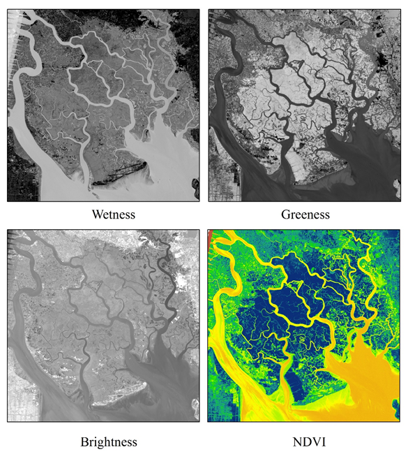
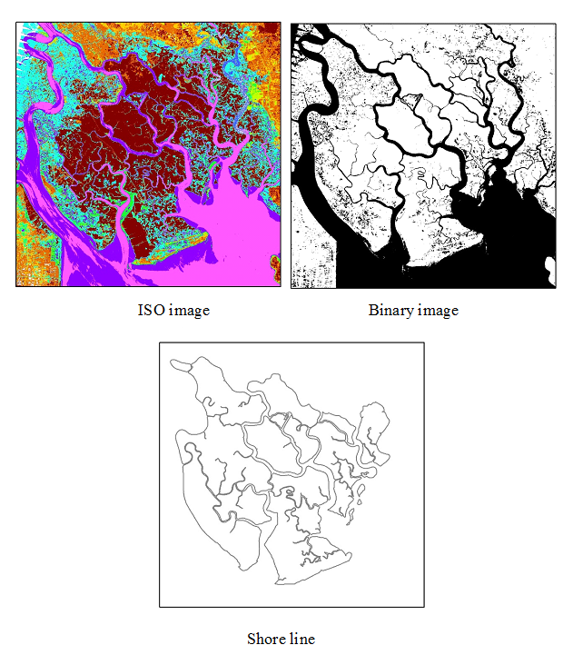
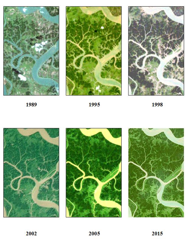
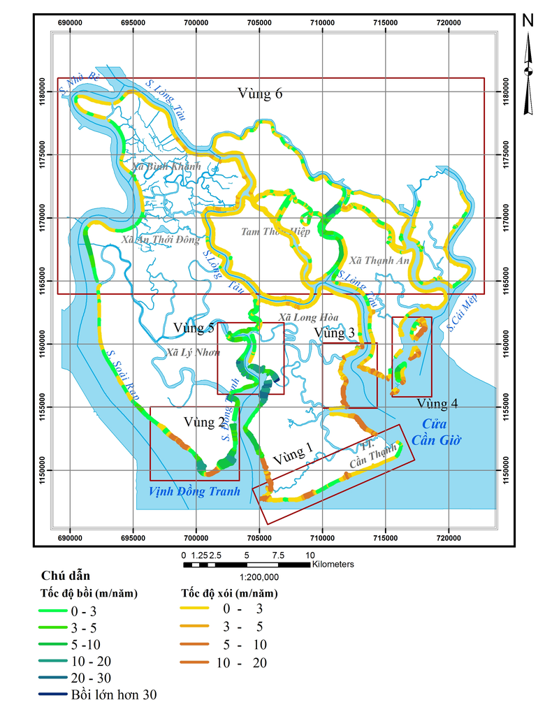
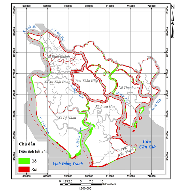
Required software: ArcGIS, IDRISI, DSAS\nTask:\n1. Analyis landsat image (5,7,8) from 1989-2015\n2. Interpret, detect and automatic digitize shoreline each year.\n3 Calculate erosion rate and area.\nReference:\n1. Scott Jr (2003). Using the landsat 7 enhanced thematic mapper tasseled cap transformation to extract shoreline.\n2. E Robert Thieler, Emily A Himmelstoss, Jessica L Zichichi và Ayhan Ergul (2009). The Digital Shoreline Analysis System (DSAS) Version 4.0-An ArcGIS Extension for Calculating Shoreline Change, US Geological Survey.

Sobre Mim
Technical skills: 1. Strong GIS skills with Arcgis, Surfer, Mapinfo: digitize, cartography, topology, metadata, analyze image, spatial statistics, model builder. 2. Strong C#, javascript, php programming skills. 3. High level of experience with GIS (4 years). 4. Knowledge of SQL server, PostGIS, PostgreSQL. 5. Expertise in diverse Open Source software and related technologies, including: openlayers, extjs, geoserver, geowebcache, mapserver. 6. Expertise in ArcGIS desktop, ArcGIS server, ArcGIS API for javascipt.